








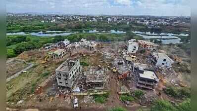
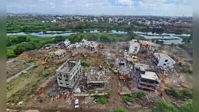
Pune: PMC has demolished only around 81,250 sq ft of illegal constructions within the blue flood lines of rivers through the city in the last five years. In addition, action against encroachments on nullahs (natural streams) has also been minimal, according to official data revealed in a written reply from the civic administration to elected members.Civic data shows that just 23 notices were issued in the past five years against illegal constructions along natural streams across the city. Following these, around 95,000 sq ft of encroachments were removed from the streams.As far as flood lines go, a total of 69 notices have been issued covering an unauthorised area of approximately 85,250 sq ft. Direct action has been executed to clear and remove unauthorised structures across 81,250 sq ft of that area, says data with Pune Municipal Corporation (PMC).Activists claimed that the corporation is purposely ignoring these constructions, and alleged that action taken is eyewash. “Some civic officials are hand-in-glove with local politicians and contractors. This nexus promotes illegal constructions in restricted zones,” said Vijay Kumbhar of Surajya Sangharsh Samiti, a citizens’ group.“It is evident that a large number of illegal constructions are present over nullahs. It has led to flash flooding in the past. Areas like Ambil Odha saw massive waterlogging and damage just a few years ago. PMC must take up the removal of such encroachments on priority,” said Chinmay Joshi, a resident of Satara Road.Speaking to TOI, PMC city engineer Aniruddha Pawaskar only said, “Regular monitoring is carried out to curb encroachments. The civic administration is using new technology to watch illegal constructions in the restricted zones.”A senior civic official, who spoke to TOI on condition of anonymity, elaborated that PMC is making advanced efforts to address the issue. He said the administration is leveraging high-resolution satellite imagery combined with Geographic Information System (GIS) data to detect changes in properties located in flood lines to pinpoint illegal constructions.“In association with other agencies, PMC is developing advanced 3D mapping and ‘3D Digital Twin’ models. By harnessing Geo-AI and spatial analytics, these projects aim to create virtual simulations of Pune’s flood-prone nullahs and river corridors to monitor encroachments across the municipal area,” the senior official said.He added, “These images allow the administration to systematically compare historical topographical data with real-time ground conditions to flag unauthorised alterations within riverine buffer zones.”What are flood lines?Flood lines are artificial lines demarcated on paper alongside rivers. The red line is based on the maximum water level, which possibly happens only once in 100 years, whereas the blue line is demarcated as per the maximum flood discharge in 25 years. The prohibited zone is defined as the area between the two blue lines on either side of rivers, like the Mula-Mutha for Pune.The restricted zone for construction is the area between the blue line and the red line. They are also marked in the development plan (DP) and development control rules (DCR) of local self-governing bodies like PMC and PCMC, and are referred to when giving building permissions.
About The Author